

Show all 16 photos on the page Show fewer photos
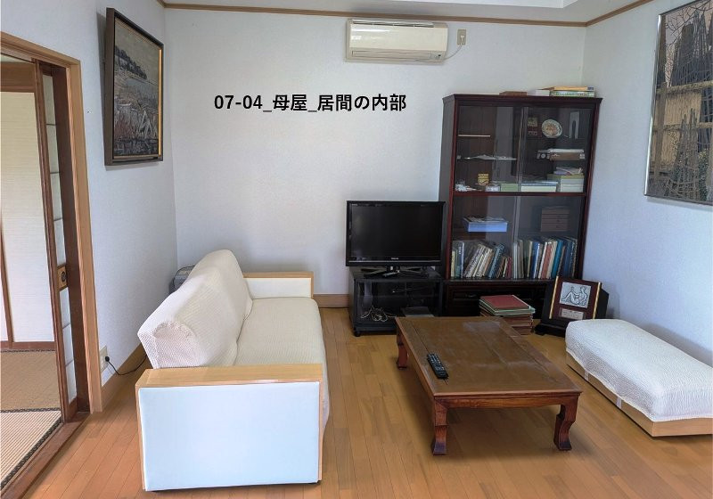
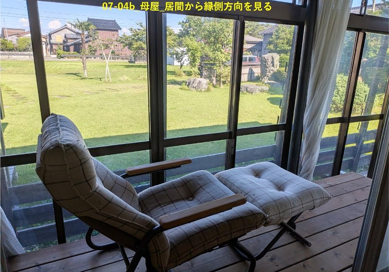
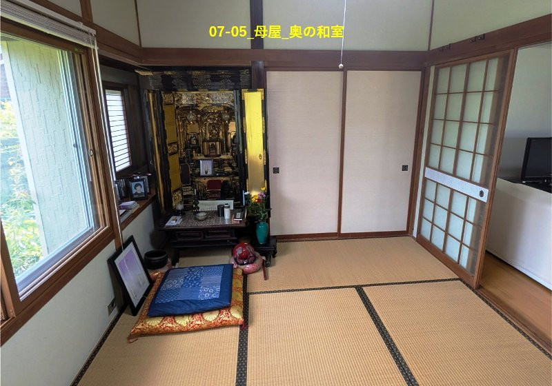
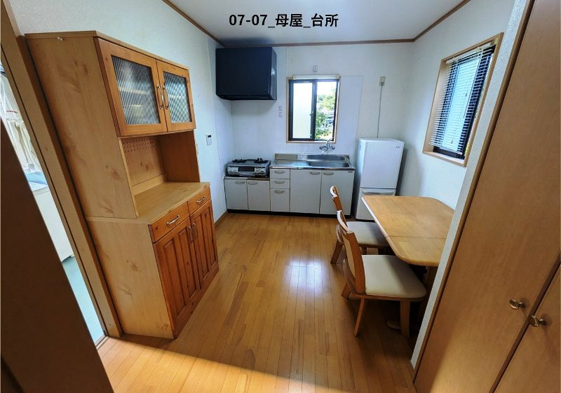
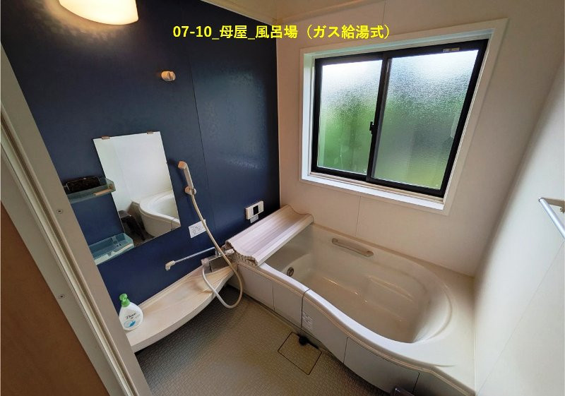
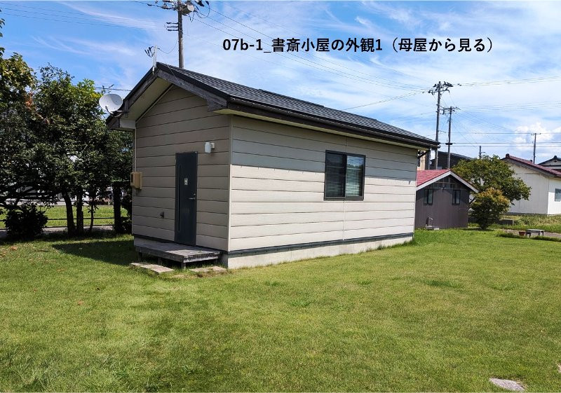
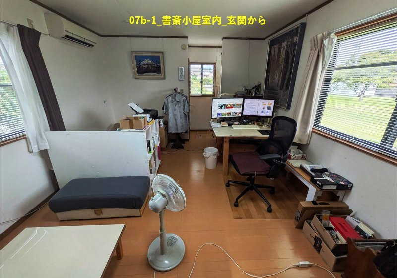
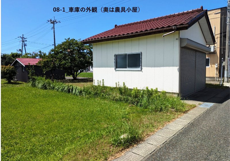

Wood house, 15-min walk to station, Kashiwazaki, Niigata
Kashiwazaki, Niigata
- Year built
- Not available
- Building size
- 122.41 sqm
- Land size
- 463.36 sqm
- Structure
- Wood
Saved homes live in this browser. View your saved homes
From the listing
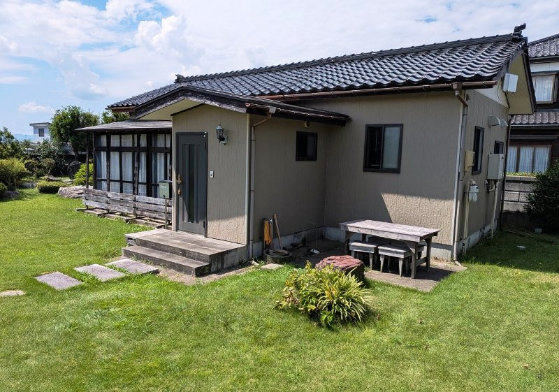
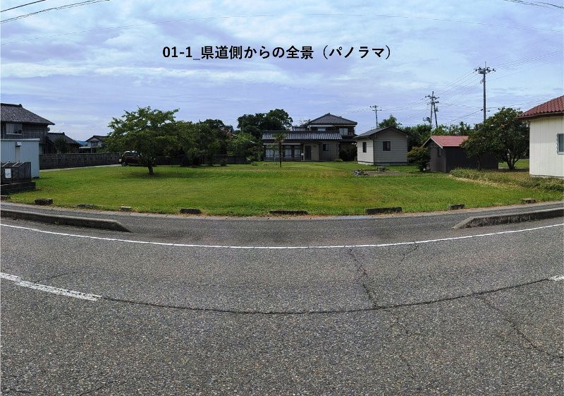
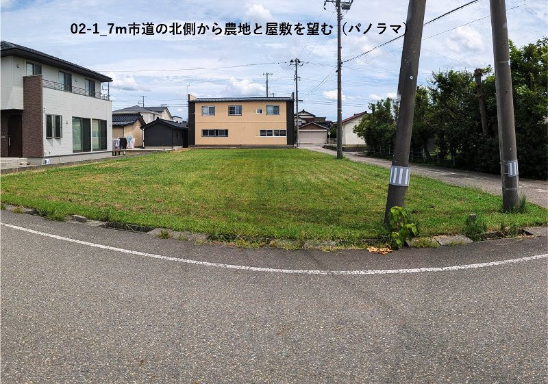
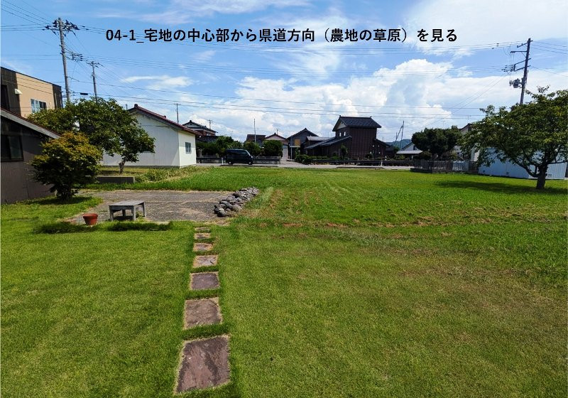
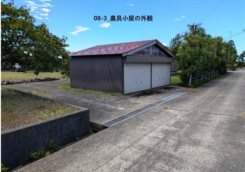
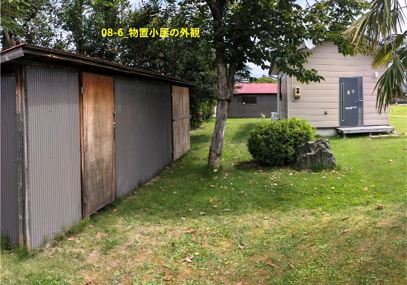
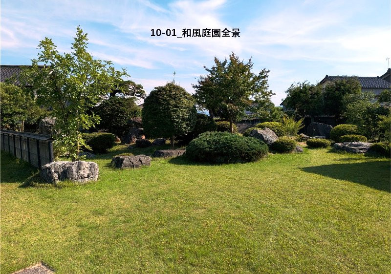
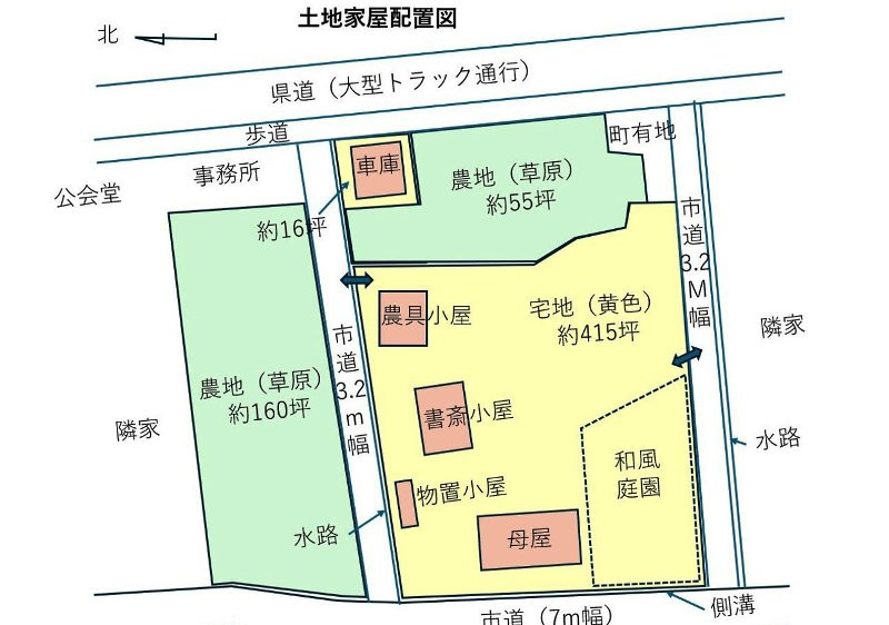
The property consists of approximately 430 tsubo of residential land and approximately 55 tsubo of farmland connected on the main-house side (485 tsubo total), plus approximately 160 tsubo of farmland north of the municipal road. The portion that was previously paddy field was leveled approximately 50 years ago. Currently not cultivated but regularly maintained with grass-cutting. Two small single-story houses, a garage facing the prefectural road, a farm-tool shed along the municipal road, and a small storage shed near the residence. Additionally, a traditional Japanese garden occupying approximately 70 tsubo on the southwest portion of the property with expensive stones arranged by the late mother. / East side faces the prefectural road used by large trucks; west side faces a separate 7m municipal road. Suitable for vehicle access from both sides, making it ideal for corporate material storage, vehicle depot, office-warehouse facilities, or residential development land (all farmland confirmed as Type 3 agricultural land and non-under-agricultural-promotion-area by municipal office). Roadside location with easy vehicle access from Nagaoka, Ojiya, and Joetsu. / For individuals, agricultural land is included, so the property targets those who can obtain Article 3 or Article 5 agricultural permits. Article 3 permits now have lower barriers and are possible with part-time farming if motivated. Application procedures conducted in flexible consultation environment, making it ideal for new farmers, relocated residents, or serious home-garden gardening. Farmland is flat grassland so construction costs can be reduced. / Infrastructure (electricity, gas, water) currently in place as property is actively lived-in. / Buildings, garage, shed, stone-face walls, block walls, garden trees, and stones transferred as-is in current condition. / Seller will not conduct survey or boundary confirmation. / Transaction based on registered land area (public area); any discrepancy with actual area will not result in price adjustment per terms requested. / Property includes farmland requiring Article 3 (farmer qualifications, etc.) or Article 5 (conversion permit) under Agricultural Land Law. Procedures take 2 to 3 months from application to permit; if permit is denied, transaction becomes null and void per agreement. / Currently in use and immediately habitable condition. / Handover timing negotiable considering seller's cleanup needs. / Transaction conducted with seller indemnified from contract non-conformity liability (no warranty). / Furniture and items inside building to be removed before handover (partial transfer negotiable). / Farm equipment, pruning tools, carpentry tools, etc. transferable at no cost per request.
Specifications
- Land size
- 463.36 sqm
- Building size
- 122.41 sqm
- Structure
- Wood
- Gas
- City gas
- Water
- City water
Where a detail is not shown, the source listing did not state it. We leave it out rather than guess.
The price in context
The nearest official land-price benchmark is about 32,900 yen per sqm, down about 12% over five years (37,200 to 32,900), which the survey classes as declining.
The asking price works out at about 25,466 yen per sqm of land, 23% below the nearest residential benchmark of about 32,900 yen per sqm. The benchmark is for bare land; akiya prices usually bundle a worn building, so a large gap is normal and does not by itself mean a bargain.
Source: Japan's Ministry of Land land-price survey. A benchmark for the area, not a valuation of this home.
Area and hazard data
2 checks clear, 3 to know about. Each check is against a government map for this exact point. Where a map is missing or we can't use it, we say so; that never means there's no risk.
- Strong-earthquake chance Note
- About 24% chance of a strong quake (shindo 6-lower or above) in 30 years, mid-range for Japan, where most places sit between 3% and 26%
- Landslide risk Checked, clear
- Checked: no designated landslide zone at this location. Zone edges are approximate, and this is not a legal property disclosure document.
- Flood risk Caution
- Within a mapped flood area, water 0.5 to 3 m
- Tsunami risk Checked, clear
- Checked: no designated tsunami inundation zone at this location
- Liquefaction Caution
- High liquefaction susceptibility. A ground survey should be part of any purchase.
Source: National earthquake-hazard model
Source: Government hazard map
Source: Government hazard map
Source: Government hazard map
Source: National landform survey
- Setting
- About 1.9 km to the nearest built-up town area (population about 36,000)
- Clinic
- About 10 min walk
Location
- Area
- Kashiwazaki, Niigata
- Setting
- About 1.9 km to the nearest built-up town area (population about 36,000)
- Clinic
- About 10 min walk
This marks an approximate area, not the exact building. The circle is a rough radius from the listing's published address, so you can see the neighbourhood without us guessing at a precise spot. The published address only names the neighbourhood.
Rules of this akiya bank
These are the bank's published eligibility rules, not confirmation that your intended use of this home is allowed. Check with the municipality and owner.
-
Residence or regular-stay requirement
Not established
No explicit buyer-residency rule found in the checked bank pages.
Unknown does not mean permitted. No restriction or permission has been inferred.
Read official bank rules Checked 2026-10-06 -
Business-use exclusion
Not established
No explicit property business-use rule found; website reuse terms are not property-use rules.
Unknown does not mean permitted. No restriction or permission has been inferred.
Read official bank rules Checked 2026-10-06 -
Resale restriction
Not established
No explicit post-purchase resale ban or holding period found. Unknown is not permission.
Unknown does not mean permitted. No restriction or permission has been inferred.
Read official bank rules Checked 2026-10-06
Not reviewed yet for this bank:
- Registration before viewing
- Years you must live there to keep a subsidy
- Years before you may resell
Thinking of renting it out?
What the published rules and maps say about letting this home to short-stay guests, line by line, with sources. This is not a verdict or advice. The town, the bank and the licensing office have the final word.
In Japan, home-sharing (minpaku) under the national home-sharing law is capped at 180 nights a year. A ryokan or inn licence is a separate route with its own building and zoning rules.
-
Bank rule on living in the home
Unknown. No published residence rule has been established for this listing.
Unknown does not mean permitted. The bank or the town can say whether buyers are expected to live in the home.
Bank rules Checked 2026-10-06 -
Bank rule on business use
Unknown. No published business-use rule has been established for this listing.
Unknown does not mean permitted. The bank can say whether guest stays fit its rules.
Bank rules Checked 2026-10-06 -
Bank rule on resale
Unknown. No published resale rule has been established for this listing.
Unknown does not mean permitted. The bank can say whether a resale restriction applies.
Bank rules Checked 2026-10-06 -
Local home-sharing ordinance
Niigata Prefecture has an ordinance that limits where or when home-sharing runs.
On top of the 180-night national cap, the ordinance can rule out some areas or periods, so the exact address matters.
Japan Tourism Agency ordinance list List dated 2021-04-01 -
Zoning for hotels and inns
Unknown. Zoning data for this spot is not loaded yet.
Unknown does not mean permitted. The town's planning desk holds the zoning map.
-
Urbanisation control area
Unknown. Area division data is not available for this spot.
Unknown does not mean permitted. The town's planning desk can say whether the home is in an urbanisation control area.
-
Heavy-snow designation
Unknown. The heavy-snow map is not checked for this spot.
The town can say how much snow falls and who clears the road.
-
Distance to an airport and the shinkansen
Nearest airport about 76.4 km, nearest shinkansen station about 22.8 km, in a straight line.
How easily guests arrive shapes demand. Road and rail journeys are longer than these distances.
Airports (MLIT) FY2021 data, read 2026-10-15Rail stations (MLIT) FY2025 data, read 2026-10-15
Read more
Grants and rules
2 programmes in our data could apply to this home, all with conditions you would have to meet first. Amounts change every year. Always confirm with the town before you rely on a figure.
-
Regional Revitalization Migration Support Program (Household) ConditionalUp to 1,000,000 yen
What you would need
Base amount for household migration: up to 1 million yen. Additional 1 million yen per child under 18 may be added (stackable add-on, not included in base cap).
- Resident of Tokyo 23 wards or commuting to Tokyo 23 wards from Tokyo Metropolitan Area (excluding disadvantaged regions)
- Plus 3 more conditions on the town's page.
-
Regional Revitalization Migration Support Program (Single) ConditionalUp to 600,000 yen
What you would need
Base amount for single migration: up to 600,000 yen.
- Resident of Tokyo 23 wards or commuting to Tokyo 23 wards from Tokyo Metropolitan Area (excluding disadvantaged regions)
- Plus 3 more conditions on the town's page.
Official source for Regional Revitalization Migration Support Program (Single) (opens in a new tab)
- Municipal conditions and restrictions
-
- Agricultural Land Law Article 3 (farmer qualifications, etc.) or Article 5 (conversion permit) required
- Approximately 2 to 3 months processing time from application to permit
Interested in this house?
Every message gets a reply from one of the founders. We can talk through the home, help you think about a renovation, and connect you with a licensed agent in Japan for buying help. Clear flat fee pricing, nothing to pay until you decide to go ahead.
- 1Tell us where you are and what you would use it for.
- 2We check the home and the town's rules with you, free.
- 3If you go ahead, a licensed agent in Japan handles the purchase for a flat fee.

4 other homes currently listed in Kashiwazaki.
Kashiwazaki, Niigata
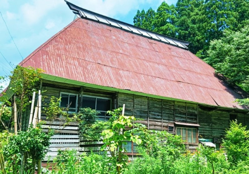
1870s wood house in Kashiwazaki, Niigata
990,000 yen
(approx. GBP 5,000)
Kashiwazaki, Niigata
1970s wood house on a large plot in Kashiwazaki, Niigata
430,000 yen
(approx. GBP 2,000)
Kashiwazaki, Niigata
Wood house in Kashiwazaki, Niigata
2,990,000 yen
(approx. GBP 14,000)
Before you buy
Where this data comes from
Every fact on this page comes from the town's own listing or an official government record, checked for this address. Where a fact is missing, we say so rather than guess.
- Landslide-risk areas, from Japan's Ministry of Land mapping data (KSJ A33).
- Flood-risk areas, from Japan's Ministry of Land mapping data (KSJ A31a).
- Tsunami-risk areas, from Japan's Ministry of Land mapping data (KSJ A40).
- Earthquake-hazard forecast, from the national J-SHIS model (2024).
- Stations, coastline and schools, from Japan's Ministry of Land mapping data.
- Official land prices, from Japan's Ministry of Land land-price survey.
Map data: National Land Numerical Information (Kokudo Suchi Joho), Ministry of Land, Infrastructure, Transport and Tourism, processed by Engawa.
出典:「国土数値情報」(国土交通省)(https://nlftp.mlit.go.jp/ksj/)をEngawaが加工して作成
- Checked against the town's listing
- Checked against the town's listing: 2026-10-15
- Source listing last changed
- Source listing last changed: 2026-10-15
- Original listing
- www.ieichiba.com (opens in a new tab)
We re-check listings against their sources through the week. Where a fact is missing, we say so rather than guess. Data from the source listing plus official government records.