
Saved homes live in this browser. View your saved homes
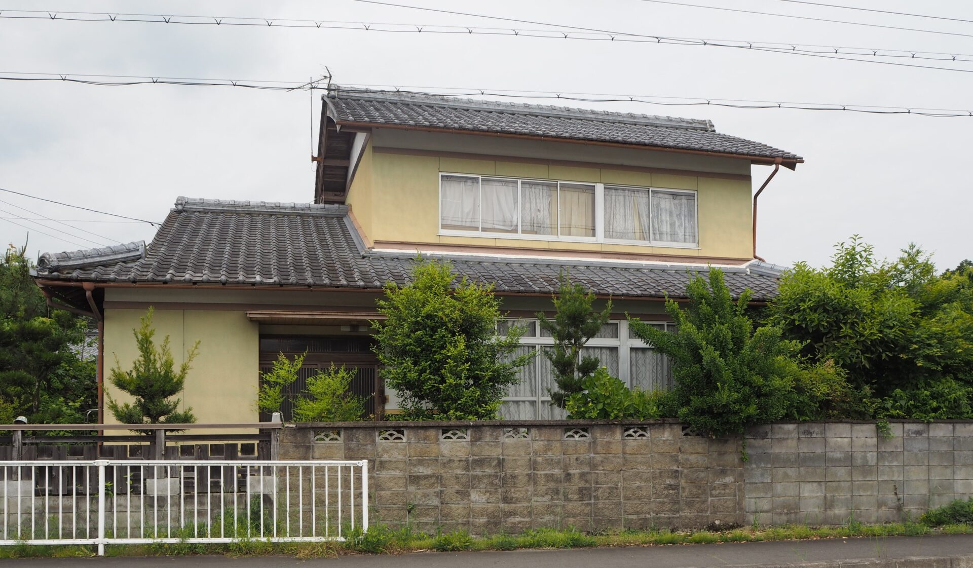
Wood house on a large plot in Monobe, Ayabe
Ayabe, Kyoto
- Year built
- Not available
- Building size
- 137.38 sqm
- Land size
- 201.65 sqm
- Structure
- Wood


About this home
The main house sits a 544 metre walk from Monobe primary and 718 from the junior high at Kahoku; this is heavy snow country, so the septic tank and the old outbuilding will want a hard look before anyone settles in.
Draft summary from the listing, not yet reviewed by a founder.
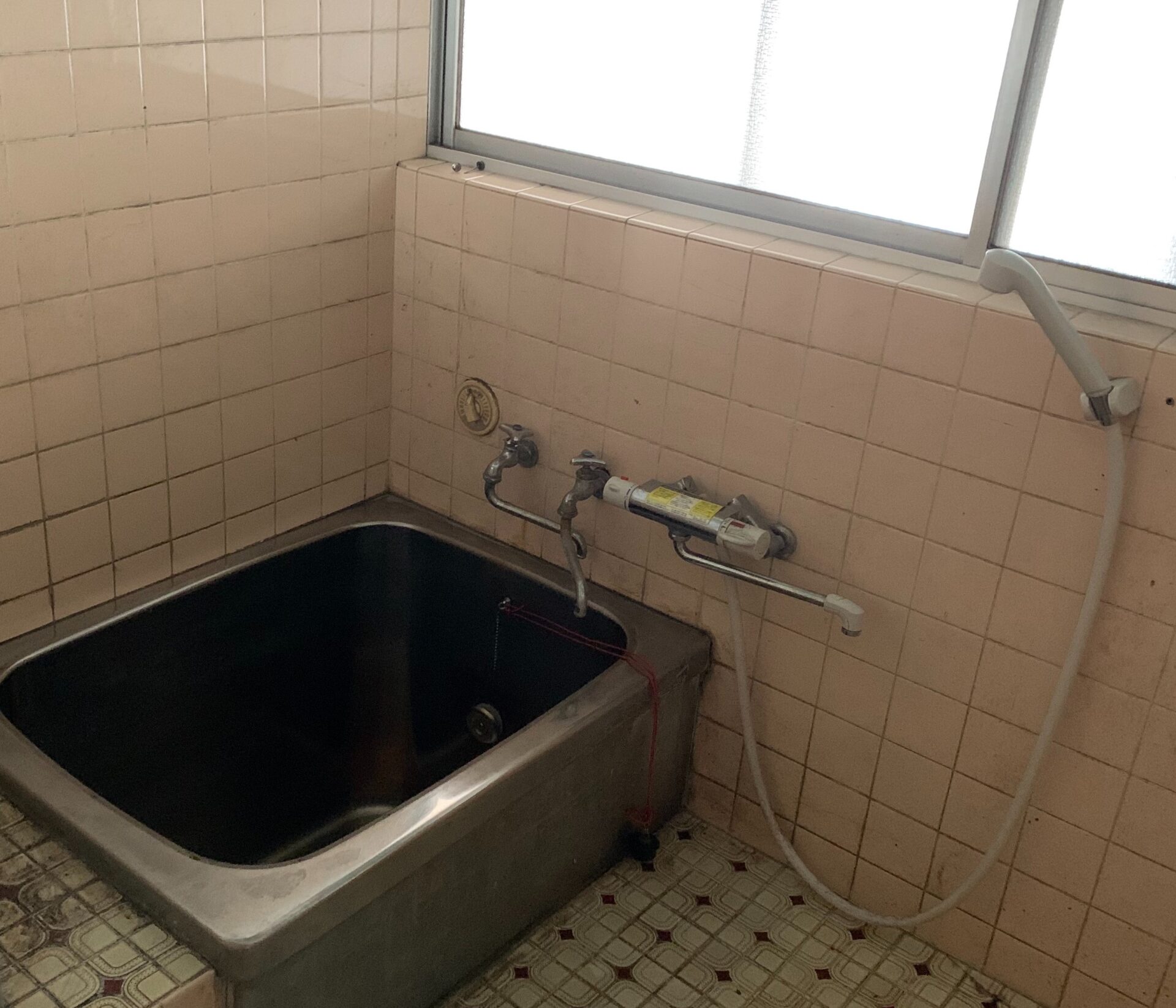
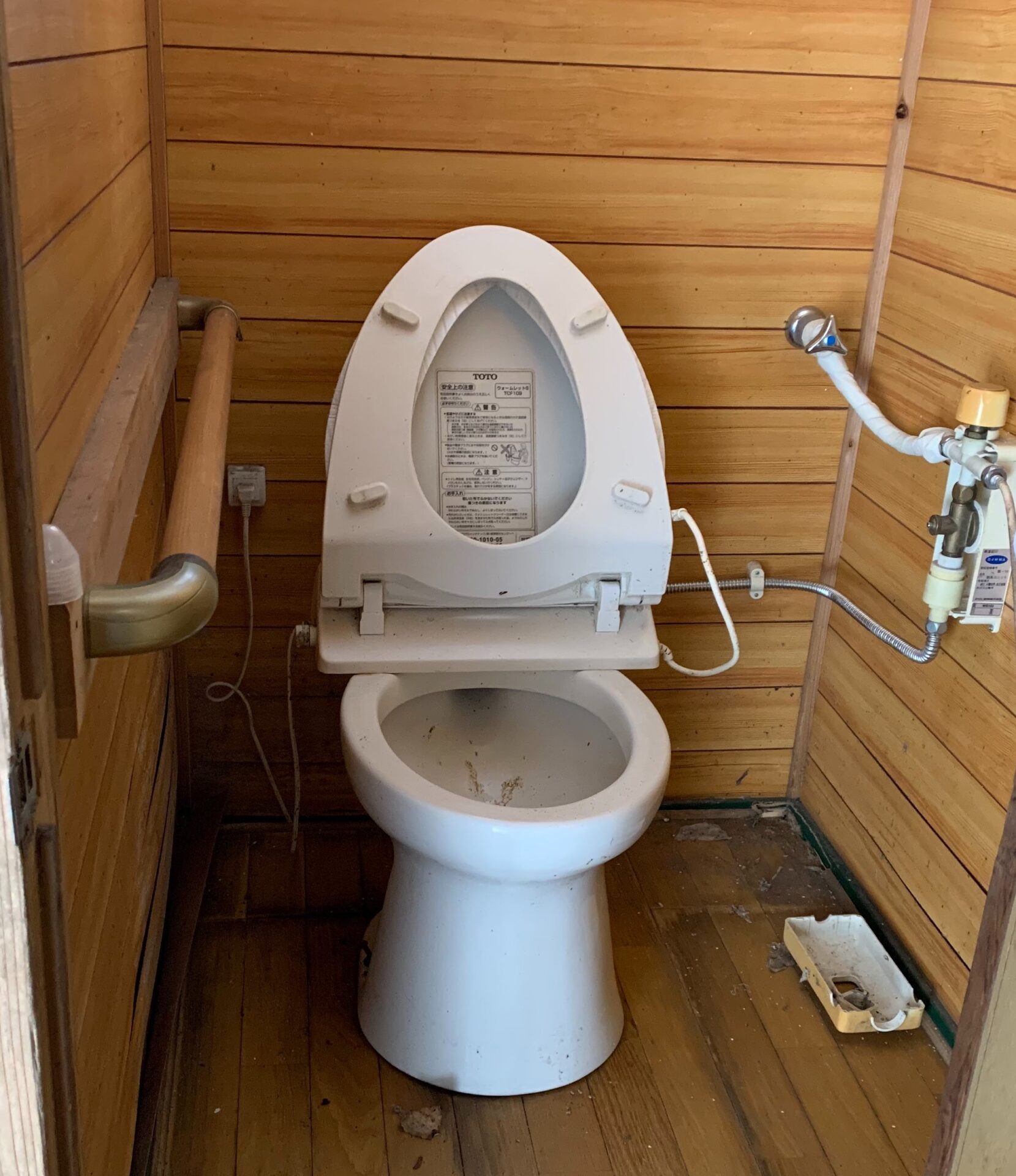
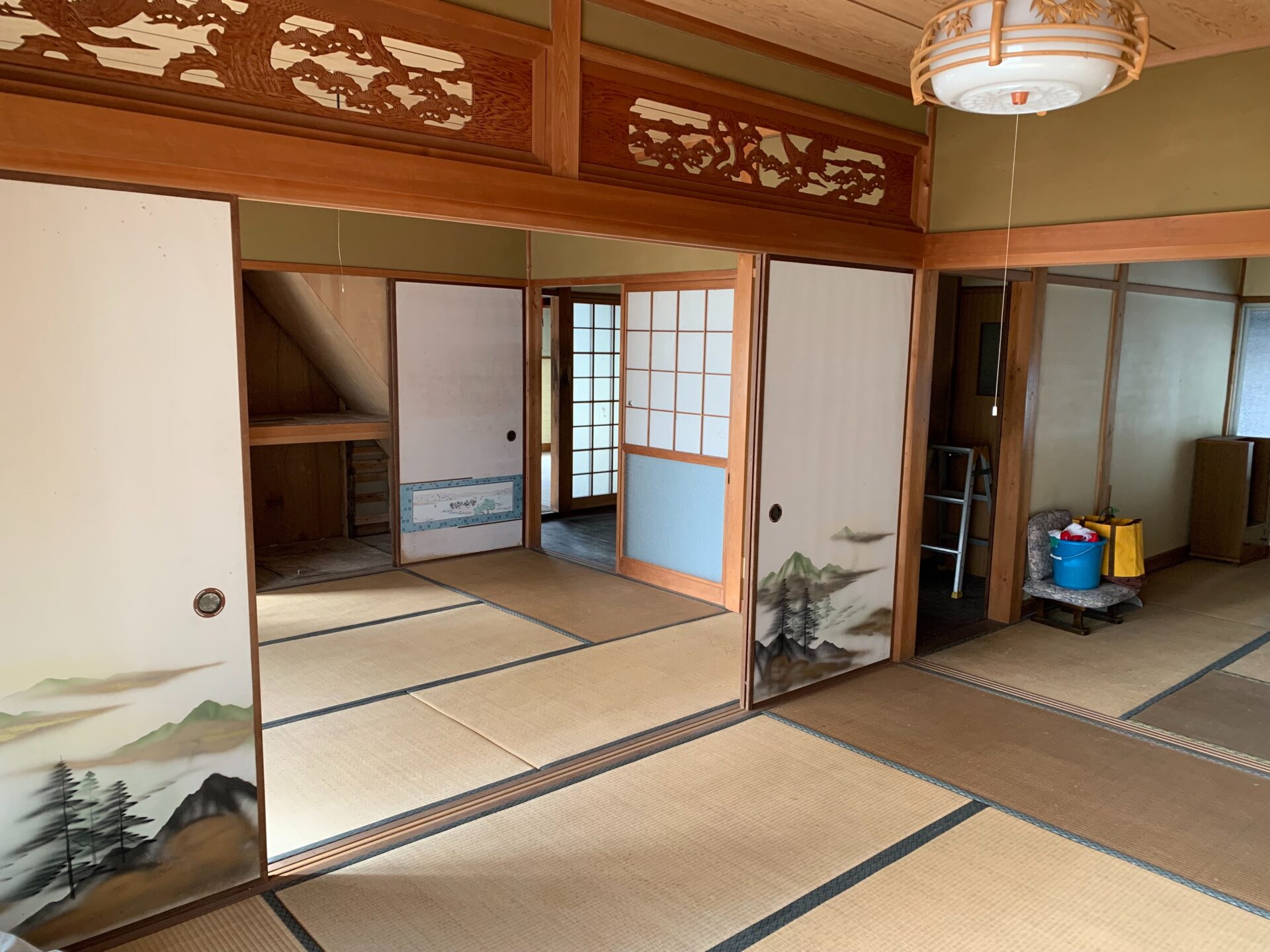
From the listing Attached structures: 1 separate dwelling, rice field (4,010 sqm), vegetable field (2,261 sqm), miscellaneous land (13 sqm), forest (6,954 sqm) / Renovation required / Utilities: Kansai Electric, municipal water, well water, toilet (pit toilet: simple flush) / Repair costs borne by buyer / Location: within urban planning area (restricted use zone / rural residential area) / Usage status: occupied until approximately April 2021 / management continuing
Specifications
Where a detail is not shown, the source listing did not state it. We leave it out rather than guess.
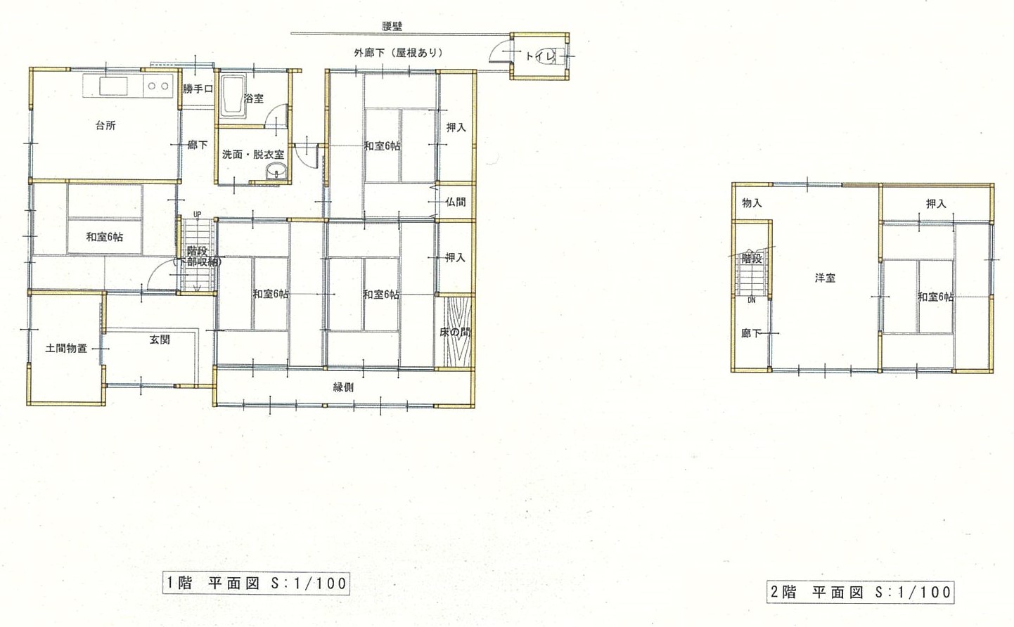
Floor plans

The price in context
241 yen
Asking price per sqm of land
5,590 yen
Nearest official land benchmark, per sqm
The nearest official land-price benchmark is about 5,590 yen per sqm, down about 1% over five years (5,660 to 5,590), which the survey classes as stable.
The asking price works out at about 241 yen per sqm of land, 96% below the nearest residential benchmark of about 5,590 yen per sqm. The benchmark is for bare land; akiya prices usually bundle a worn building, so a large gap is normal and does not by itself mean a bargain.
Source: Japan's Ministry of Land land-price survey. A benchmark for the area, not a valuation of this home.

Area and hazard data
4 checks clear, 3 to know about. Each check is against a government map for this exact point. Where a map is missing or we can't use it, we say so; that never means there's no risk.
To know about
Liquefaction
NoteModerate liquefaction susceptibility. Ask for a ground report before major work.
Source: National landform survey
Snow
NoteIn a designated heavy-snow zone. Expect real winter heating and roof-clearing costs.
Source: Government heavy-snow designation
Farmland rules
NoteInside an outer farmland zone. The plot itself may or may not be classed as farmland; ask the town before you commit.
Source: Government land-use records
Checks clear
-
Strong-earthquake chance
Checked, clearAbout 3% chance of a strong quake (shindo 6-lower or above) in 30 years, low for Japan, where most places sit between 3% and 26%
Source: National earthquake-hazard model
-
Landslide risk
Checked, clearChecked: no designated landslide zone at this location. Zone edges are approximate, and this is not a legal property disclosure document.
Source: Government hazard map
-
Flood risk
Checked, clearChecked: outside a mapped flood area. The maps cover designated rivers only, so this is not a promise of no flooding.
Source: Government hazard map
-
Tsunami risk
Checked, clearChecked: no designated tsunami inundation zone at this location
Source: Government hazard map

Location
This marks an approximate area, not the exact building. The circle is a rough radius from the listing's published address, so you can see the neighbourhood without us guessing at a precise spot. The published address only names the neighbourhood.

Rules of this akiya bank
These are the bank's published eligibility rules, not confirmation that your intended use of this home is allowed. Check with the municipality and owner.
Unknown does not mean permitted. No restriction or permission has been inferred.
-
Residence or regular-stay requirement
Not established
No explicit buyer-residency rule found in the checked bank pages.
The bank or the town can say whether buyers are expected to live in the home.
Read official bank rulesChecked 2026-10-06
-
Business-use exclusion
Not established
No explicit property business-use rule found; website reuse terms are not property-use rules.
The bank can say whether guest stays fit its rules.
Read official bank rulesChecked 2026-10-06
-
Resale restriction
Not established
No explicit post-purchase resale ban or holding period found. Unknown is not permission.
The bank can say whether a resale restriction applies.
Read official bank rulesChecked 2026-10-06
Not reviewed yet for this bank:
- Registration before viewing
- Years you must live there to keep a subsidy
- Years before you may resell

Thinking of renting it out?
What the published rules and maps say about letting this home to short-stay guests, line by line, with sources. This is not a verdict or advice. The town, the bank and the licensing office have the final word.
In Japan, home-sharing (minpaku) under the national home-sharing law is capped at 180 nights a year. A ryokan or inn licence is a separate route with its own building and zoning rules.
-
Local home-sharing ordinance
Kyoto Prefecture has an ordinance that limits where or when home-sharing runs.
On top of the 180-night national cap, the ordinance can rule out some areas or periods, so the exact address matters.
Japan Tourism Agency ordinance listList dated 2021-04-01
-
Zoning for hotels and inns
No use zone is recorded for this spot in the loaded zoning data.
That does not establish permission. The town's planning desk holds the current zoning map.
Zoning data (MLIT)FY2019 data, read 2026-10-15
-
Urbanisation control area
Unknown. Area division data is not available for this spot.
Unknown does not mean permitted. The town's planning desk can say whether the home is in an urbanisation control area.
-
Heavy-snow designation
This home is in a designated heavy-snowfall area.
Snow clearing, roof upkeep and heating add to running costs, and winter access affects guest stays.
Heavy-snow areas (MLIT)FY2016 data, read 2026-10-04
-
Distance to an airport and the shinkansen
Nearest airport about 42.9 km, nearest shinkansen station about 72 km, in a straight line.
How easily guests arrive shapes demand. Road and rail journeys are longer than these distances.
Airports (MLIT)FY2021 data, read 2026-10-04
Rail stations (MLIT)FY2025 data, read 2026-10-04

Grants and rules
10 programmes in our data could apply to this home, all with conditions you would have to meet first. Amounts change every year. Always confirm with the town before you rely on a figure.
All grants in Ayabe-
Kyoto Prefecture Wooden House Seismic Retrofit Subsidy
Up to 2,100,000 yenWhat you would need
Maximum varies by retrofit type and location. Full seismic retrofit (A-1, critical zone): up to 2,100,000 yen or 1,725,000 yen depending on snow zone. Full retrofit (A-2, non-critical zone): up to 1,400,000 yen or 1,150,000 yen. Partial retrofit (B): up to 1,200,000 yen or 1,000,000 yen. Amounts vary by municipality.
- Must conduct seismic retrofit or install seismic shelter
- Plus 2 more conditions on the town's page.
Official source for Kyoto Prefecture Wooden House Seismic Retrofit Subsidy (opens in a new tab)
-
Ayabe City Settlement Promotion Project Subsidy
Up to 1,800,000 yenWhat you would need
Up to 1,800,000 yen for registered akiya; up to 900,000 yen for unregistered akiya. Maximum subsidy is 2/3 of eligible renovation costs.
- Had residence outside the municipality for 3+ continuous years, or relocated to municipality less than 1 year ago after having 3+ years outside residence
- Plus 7 more conditions on the town's page.
Official source for Ayabe City Settlement Promotion Project Subsidy (opens in a new tab)
-
Kyoto Prefecture Migration Support Payment (General Employment at Destination)
Up to 1,000,000 yenWhat you would need
Household with dependent children (under 18): 1,000,000 yen base + up to 1,000,000 yen per child (max 100万円 per child); Single: 600,000 yen. Varies by municipality.
- Resident of Tokyo 23 special wards or surrounding area commuting to Tokyo 23 wards
- Plus 4 more conditions on the town's page.
-
Kyoto Prefecture Migration Support Payment (Professional Employment)
Up to 1,000,000 yenWhat you would need
Same structure: household up to 1,000,000 yen base, single 600,000 yen, with child add-ons up to 100万円 per dependent.
- Resident of Tokyo 23 special wards or surrounding area
- Plus 3 more conditions on the town's page.
-
Kyoto Prefecture Migration Support Payment (Startup at Destination)
Up to 1,000,000 yenWhat you would need
Household up to 1,000,000 yen base, single 600,000 yen. Child add-ons up to 100万円 per dependent. Varies by municipality.
- Resident of Tokyo 23 special wards or surrounding area
- Plus 3 more conditions on the town's page.
-
Kyoto Prefecture Migration Support Payment (Telework)
Up to 1,000,000 yenWhat you would need
Same tiered structure as general employment: household up to 1,000,000 yen, single 600,000 yen. Varies by municipality.
- Resident of Tokyo 23 special wards or surrounding area
- Plus 3 more conditions on the town's page.
Official source for Kyoto Prefecture Migration Support Payment (Telework) (opens in a new tab)
-
Regional Revitalization Migration Support Program (Household)
Up to 1,000,000 yenWhat you would need
Base amount for household migration: up to 1 million yen. Additional 1 million yen per child under 18 may be added (stackable add-on, not included in base cap).
- Resident of Tokyo 23 wards or commuting to Tokyo 23 wards from Tokyo Metropolitan Area (excluding disadvantaged regions)
- Plus 3 more conditions on the town's page.
-
Regional Revitalization Migration Support Program (Single)
Up to 600,000 yenWhat you would need
Base amount for single migration: up to 600,000 yen.
- Resident of Tokyo 23 wards or commuting to Tokyo 23 wards from Tokyo Metropolitan Area (excluding disadvantaged regions)
- Plus 3 more conditions on the town's page.
Official source for Regional Revitalization Migration Support Program (Single) (opens in a new tab)
-
Kyoto Prefecture Akiya Circulation Promotion, Clearance/Debris Removal Grant
Up to 50% of clearance/removal cost; cap set separately by governor. Amounts vary by municipality.What you would need
- Registered akiya owner conducting clearance/cleanup for migrant occupancy
- Plus 2 more conditions on the town's page.
-
Kyoto Prefecture Migration-Promotion Housing Development, Akiya Renovation Grant
Up to 50% of renovation cost. Cap determined separately by the governor. Amounts vary by municipality; must consult specific municipality.What you would need
- Migrant acquiring or leasing a registered akiya
- Plus 3 more conditions on the town's page.
- Municipal conditions and restrictions
-
- Membership in local neighborhood association required
Always confirm the current conditions with the town before you commit.

How to buy: through the town.
This home is on the Ayabe akiya bank. The town puts you in touch with the seller and explains its rules.
If the town says a local estate agent handles the sale, Koryoya can help you in English. Ask us.
- Free to ask us. We read the listing with you, help with the Japanese and explain each step.
- There are always some costs, such as registration and legal fees, even for a free house.
Interested in this house?
A founder replies by email. Free to ask.
More homes in Ayabe
46 other homes currently listed in Ayabe.
Ayabe, Kyoto
2010s wood house, 15-min walk to station, Higashiyama, Ayabe
1,000,000 yen
(approx. GBP 5,000)
Ayabe, Kyoto
1970s wood house, 16-min walk to station, Ayabe, Kyoto
800,000 yen
(approx. GBP 4,000)
Ayabe, Kyoto
Wood house in Ayabe, Kyoto, farmland, approval needed
2,900,000 yen
(approx. GBP 13,000)
Before you buy
Where this data comes from
Every fact on this page comes from the town's own listing or an official government record, checked for this address. Where a fact is missing, we say so rather than guess.
- Landslide-risk areas, from Japan's Ministry of Land mapping data (KSJ A33).
- Flood-risk areas, from Japan's Ministry of Land mapping data (KSJ A31a).
- Tsunami-risk areas, from Japan's Ministry of Land mapping data (KSJ A40).
- Earthquake-hazard forecast, from the national J-SHIS model (2024).
- Farmland rules, from Japan's Ministry of Land mapping data (KSJ A12).
- Stations, coastline and schools, from Japan's Ministry of Land mapping data.
- Official land prices, from Japan's Ministry of Land land-price survey.
Map data: National Land Numerical Information (Kokudo Suchi Joho), Ministry of Land, Infrastructure, Transport and Tourism, processed by Engawa.
出典:「国土数値情報」(国土交通省)(https://nlftp.mlit.go.jp/ksj/)をEngawaが加工して作成
We re-check listings against their sources through the week. Where a fact is missing, we say so rather than guess. Data from the source listing plus official government records.